Cypress Hills
Community Assessment & Adaptation Options:
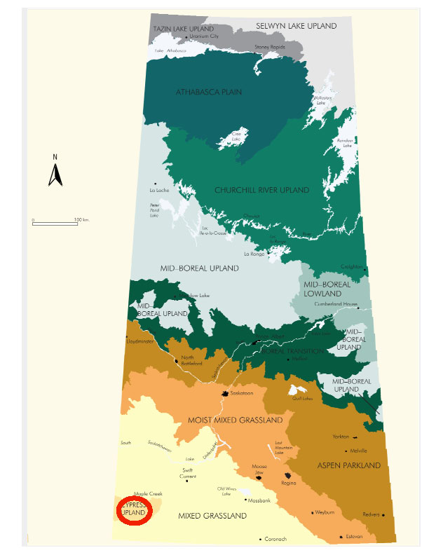
Cypress Hills is located in southwestern Saskatchewan along the Alberta/Saskatchewan border and forms the Cypress Hills Upland Ecoregion. The Cypress Hills are unique, being the highest elevation east of the Rockies in southern Canada, the only lodgepole pine forest found in Saskatchewan and the home of an abundant variety of orchids. Much of the Cypress Hills is designated as an inter-provincial park, Fort Walsh National Historic Park is also located here. The vegetation cover is a mix of fescue prairie, with lodgepole pine, white spruce and aspen forest occuring primarily on the slopes.
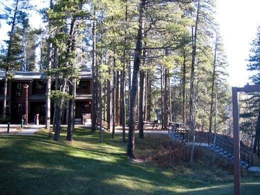
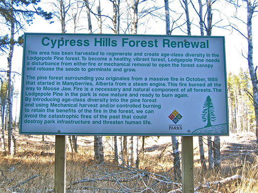
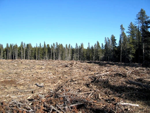
Recent vegetation management has focused on fire protection and forest renewal (Figures 3 & 4). Wildlife includes elk, white tail and mule deer, moose and trumpeter swans. The park is a major recreation and tourist attraction, while the surrounding land, part of the Mixed Grassland Ecoregion, is primarily rangeland, which supports grazing and oil and gas development.
The Mixed Grassland Ecoregion extends south into the United States and is dominated by agricultural use. Nearly 50% of the ecoregion is cultivated while the remainder is largely rangeland or designated parkland or protected areas. Irrigation is a major water user and there are many small dams and reservoirs present. The ecoregion is important wildlife habitat for both upland and waterfowl species. Outdoor recreation and tourism are growing economic sectors. Some communities within the ecoregion, such as Maple Creek and Assiniboia, are thriving.
Climate Normals (1971-2000)
- The average daily temperature ranges from -9.5°C in January to 15.4°C in July with 5 months being below 0 (November to March). The lowest average daily minimum temperature is -15.6°C experienced in January and the highest average daily maximum temperature of 22.8°C is experienced in August.
- The annual precipitation is about 606.8 mm of which 57% is rainfall and the remainder is snow. 47% falls in the months of April, May, June, July.
- Based on Maple Creek, the closest town, an indication of the demand for cooling and heating is provided by the number of degree days above 18°C - 175.7; and the number of degree days below 18°C - 4754.
Future Climate
Over the century to 2100 climate scenarios suggest:
- A warmer climate - temperatures may generally rise 2 to 4 degrees.
- A longer growing season - but drier, despite an increase in precipitation. This is a result of increased summer temperatures and increased evapotranspiration.
- Expect more frequent and more intense extreme events (e.g. heavy precipitation or drought). Droughts will likely increase in intensity and frequency.
Regional Adaptation Options
- To reduce risks under future climate uncertainty, use zoning to manage different parts of the forest with different techniques.
- Forest retention should be a priority. This may require an aggressive response to pests (e.g. Mountain Pine Beetle) and disease, reduction of fire risk and identification of plant species for propagation better adapted to climate change.
- For more detail on forest management options see Henderson et al (2002).
- Under climate change, the primary issue for communities, agriculture, and other economic activities will be water management to handle both flood and drought situations.
- Soil and moisture conservation should continue to be an agricultural priority.
- Native grassland can be expected to adapt to drier conditions, including changes in species composition. Stocking rates and/or grazing periods may have to be adjusted.
- Development associated with oil and gas extraction may have to alter the operating season to when the ground is frozen and adjust reclamation seed mixes.
- The longer tourist season is an opportunity.
Sources:
- Acton, D.F., Padbury,G.A., Stushnoff,C.T. (1998): The Ecoregions of Saskatchewan. Canadian Plains Research Center, University of Regina and Saskatchewan, Environment and Resource Management.
- Barrow, E. (2009b): Climate Scenarios for Saskatchewan. PARC Summary Document No. 09-01, 15p.
- Barrow, E. (2009a): Climate Scenarios for Saskatchewan. PARC, 131 p.
- Canadian Plains Research Centre (2005): Encyclopedia of Saskatchewan, Ecozones and Ecoregions.
- Environment Canada (2010): National Climate Data and Information Archive, Canadian Climate Normals, station ID:3085, Cypress Hills
- Henderson, N., Hogg, T., Barrow, E. and Dolter, B. (2002): Climate Change Impacts on the Island Forests of the Great Plains and the Implications for Nature Conservation Policy: The Outlook for Sweet Grass Hills (Montana), Cypress Hills (Alberta - Saskatchewan), Moose Mountain (Saskatchewan), Spruce Woods (Manitoba) and Turtle Mountain (Manitoba - North Dakota). PARC Summary Document No. 02-01, 12 p.
< http://www.parc.ca/pdf/research_publications/summary_docs/SD2002-01.pdf> - Saskatchewan (2010): Saskbiz, Community Profiles: Maple Creek (Cypress Hills)