Supporting Adaptation Planning in the Athabasca River Basin

PROJECT SUMMARY

The scientific objectives of this project were to develop scenarios of projected changes in the hydroclimate of the Athabasca River Basin (ARB) using innovative methods that incorporate the forcing and modes of variability in the regional hydroclimate and are applicable to adaption planning in the basin. The project provided our industrial partner, WaterSMART Solutions Ltd., with improved capabilities to deliver practical adaptive strategies for water management under climate change. The most innovative aspects of the proposed project were the novel methods of downscaling and processing of climate model outputs, such that we constructed scenarios of future climate that incorporated the internal natural variability; the most significant impact of a changing climate is a shift in water resources among seasons and years. Inter-annual variability and extreme hydrologic events, rather than long-term trends in mean runoff, present most of the challenge for managing watersheds and for designing and maintaining water conveyance and storage structures. We evaluated the capacity of high-resolution Regional Climate Models (RCMs) to simulate the full range of regional hydroclimate variability. Downscaled and bias-corrected climate data were applied to hydrological and land use models to develop future scenarios for the ARB.

Long-term Hydroclimatic Variability in the Lower North Saskatchewan River Basin

PROJECT SUMMARY

The scientific problem addressed by this project was the reliability and security of water supplies derived from the North Saskatchewan River (NSR). The industrial partner, Husky Energy, has heavy oil assets in the Lloydminster region of Saskatchewan and Alberta. These thermal projects rely on the NSR as a source of freshwater for steam generation at the oil processing facilities. Despite the apparent reliability of water supplies according to annual average flows, it is critical that we understand the factors that could limit water availability in the future for any stretch of time. This project was the first phase of a collaboration that will enable Husky to assess climate risks associated with long-term water sourcing from the NSR. The innovative science behind this project is the reconstruction of annual and seasonal river levels over past centuries and the stochastic downscaling of these proxy flows to weekly estimates. This paleohydrology captures a range of water levels, and modes of variability, that are not evident in the much shorter instrumental record. This natural variability underlies any shifts in the river hydrology caused by a changing climate. Therefore, understanding long-term natural variability is an important precursor to research on the impacts of anthropogenic climate change.

Predicting Alberta’s Water Future

PROJECT SUMMARY

The objectives of this project were to advise a research group at the University of Alberta on the application of output from climate models and provide them with bias-corrected climate projections for Alberta watersheds. The climate data consisted of daily total precipitation, maximum and minimum daily temperature, radiation, average wind speed and daily average relative humidity from a set of 11 Regional Climate Models (RCMs). We also undertook a comparison of between paleo-hydrological models and the basin hydrological models, and evaluated the RCMs to determine how well they simulate the climate and surface hydrology of selected river basins. For the inter-model comparison of paleo-hydrological models and basin hydrological models, we constructed flow duration curves (exceedance probabilities) from 900 years of weekly flow estimates for the Athabasca, North Saskatchewan and Bow Rivers. We then compared these paleo-stochastic flows to the runoff simulated by RCMs.

Water Resource Challenges for Agricultural Productivity in a Warmer Climate for the Canadian Prairies

PROJECT SUMMARY

Environment and Climate Change Canada (ECCC) provided funding to enable researchers at PARC to apply climate scenarios from ECCC’s Regional Climate Model (RCM), and other climate model data, to the prairie region for a study future agricultural risks and opportunities in a warmer climate. We assessed the performance of RCMs in terms of their capacity to simulate the regional temperature and precipitation patterns and teleconnections with Pacific Ocean oscillations. We also analyzed the main sources of uncertainty in the projection of the future climate of western Canada. Climate change scenarios, derived from RCM data, were translated into useful information for the agricultural sector.

Long-term Variability and Reliability of the Flow of the Athabasca River

PROJECT SUMMARY

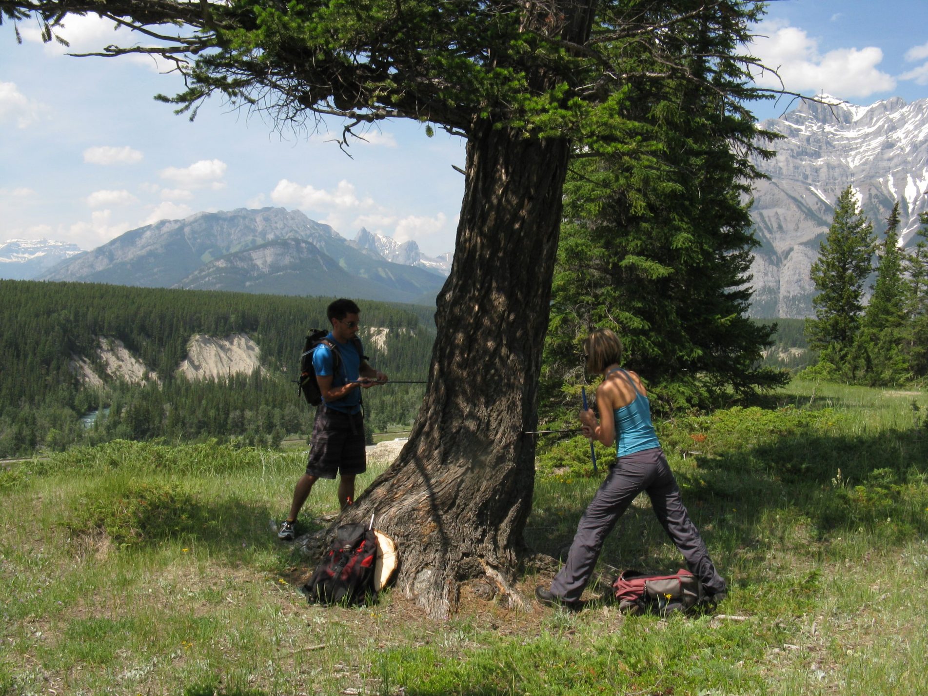
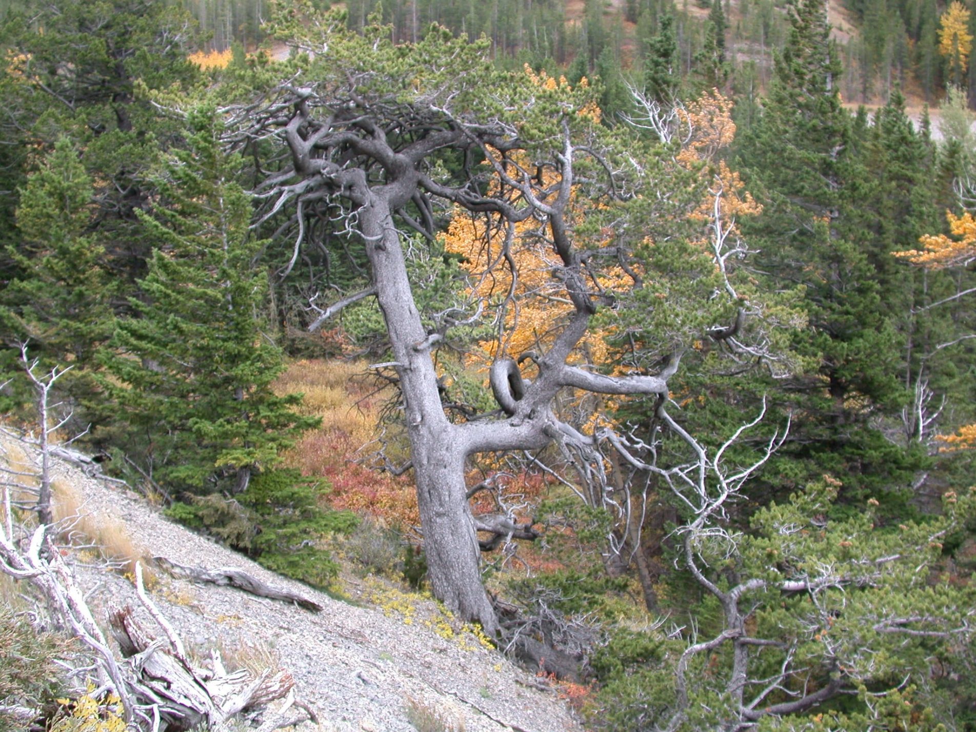
The research problem addressed by this project was the long-term variability and reliability of the flow of the Athabasca River, which is the major source of water for the extraction and processing of bitumen from the oil sands in north-eastern Alberta. The corresponding research questions were 1) to what extent do gauged flows, which are the basis for surface water allocation, fail to capture the full range of hydroclimatic variability and extremes evident in a longer proxy record, and 2) what are the implications for oil sands extraction and processing of this paleohydrology. The primary objective was achieved by reconstructing the annual and seasonal flow of the Athabasca River for the past 900 years using annual growth increments from old trees at a network of sites in the upper reaches of the river basin and in adjacent watersheds. The industrial partner, Canada’s Oil Sands Innovation Alliance (COSIA) is a collaboration of oil sands producers focused on accelerating the pace of improvement in environmental performance in Canada’s oil sands through collaborative action and innovation. COSIA shared the research findings with the oil sands producers that comprise their alliance. The project provided the oil sands industry will an expanded perspective on the variability and reliability of their major surface water supply, a perspective that captures extremes of climate and water levels that are outside the range of recorded historical flows.

Future Hydroclimate Extremes and Adaptive Basin Planning, Oldman and South Saskatchewan River Basins

PROJECT SUMMARY

The sustainable use of Alberta’s freshwater supplies relies on a solid understanding of their distribution geographically and over time as the climate varies. Major freshwater challenges are arising with a growing population, economic growth, and the interactions between economic development and a changing climate. Nowhere in Canada are these issues more insistent than in the South Saskatchewan River Basin (SSRB), where three of four sub-basins were closed to new water allocations following historically low water levels in 2001. To address this concern, WaterSMART Solutions initiated the SSRB Adaptation to Climate Variability Project, bringing together water users and managers to explore opportunities to improve the resiliency of water management in the SSRB. Presented with projections of future hydroclimate, including the most extreme scenarios, plus stakeholder observations, the project participants proposed and evaluated potential risk management and adaption strategies. The projections of future hydroclimate were developed by researchers at PARC. For the Oldman and South Saskatchewan sub-basins, we derived climate change scenarios from Global Climate Models (GCMs) and applied these scenarios to generalized-least-squares (GLS) regression models of the climate forcing of river flow. For the Red Deer River basin, we used data from 10 runs of Regional Climate Model (RCMs) from the North American Regional Climate Change Assessment Program (NARCCAP).

Sustainable Urban Water Management in the Context of Climate Variability and Change

PROJECT SUMMARY

The primary objective this project was to generate up to 1000 years of weekly stream flows for the Bow River at Calgary and North Saskatchewan River at Edmonton. This unique data set enabled a secondary objective: an evaluation of the reliability of current water supply and management systems given the range of hydro-climatic variability and extremes in this unique paleo and projected hydrology. To achieve the first objective, we combined the methodologies of paleohydrology, the study of water over centuries and millennia, and stochastic hydrology, the use of statistical methods to generate randomized hydrological times series that closely represent natural hydrologic processes. Stochastic hydrology provides hydrologic variability that is statistically likely to occur, but also more challenging to manage than historic flows, either in terms of the magnitude of individual events or their duration. One of the main shortcomings of stochastic hydrology is that the generated output series preserve the annual flow statistics of relatively short historic records. Using paleoclimatic data to generate 1000 years of weekly flow estimates introduces hydrologic variability and sequences of wet and dry years that are not evident in the short historic flow record. From centuries of weekly river flows we can derive a) long-term past probabilities of low flows of specific severity and duration, b) evaluate the reliability of gauge records as the basis for nearly all decisions about water allocation, diversion and storage, and c) transfer of this new information on hydrologic variability to water managers for their assessment and use as input into water management models.

Vulnerability and Adaptation to Climate Extremes in the Americas (VACEA)

PROJECT SUMMARY

The overall objective of this 5-year project was to improve understanding of the vulnerability of rural agricultural and indigenous communities to shifts in climate variability and to the frequency and intensity of extreme climate events, and to engage governance institutions in Canada, Argentina, Brazil, Chile and Colombia in enhancing their adaptive capacity to reduce rural community vulnerability. The VACEA project was a collaborative, comparative and interdisciplinary investigation. It addressed gaps in our knowledge of the consequences of global climate change for regional climate variability and extremes and for the associated vulnerabilities and adaptive strategies of rural communities. The project focused on rural populations that are highly vulnerable, either because they live on the social and economic margins of society or because the nature of their livelihoods makes them highly exposed and sensitive to climate variability and extremes. At local and regional scales the major climate hazards are extreme conditions rather than trends in the means. The analysis of current vulnerabilities in the context of projected shifts in climate variability and the frequency and intensity of extreme events produced important insights into future risks and opportunities, informing the adoption of more appropriate local practices and adjustments to governance policies. The project encompassed natural and social science and engineering and a conceptual model that links the different perspectives and disciplinary approaches and combines qualitative and quantitative methods, integrating various types of knowledge. In collaboration with our project partners, we achieved heightened inter-jurisdictional awareness and exchange of practices and tools for adapting to climate, including vulnerability and risk assessment, interventions that respect traditional knowledge, and communication to enhance public understanding of climate change adaptation strategies and their benefits. The project linked initiatives across sectors and disciplines, involved partnership and collaboration with various non-academic partners, enhanced collaboration among researchers from Canada and four Latin American countries, and worked with multi-stakeholder groups to strengthen their commitment to achieving adaptation to climate change.

Projected Water Availability Challenges and Implications for Agricultural Productivity, Prairie Provinces

PROJECT SUMMARY

The objective of this project was to examine temperature and precipitation data from a suite of Global Climate Models (GCMs) and Regional Climate Models (RCMs) in terms of the implication for water availability for agricultural production. We first evaluated the GCMs / RCMs in terms of their capacity to simulative the climate of western Canada. We quantified differences between simulated and observed climate and bias corrected the climate projections. The climate data included mean conditions and extremes, and indices that combine temperature and precipitation, such as the Climate Moisture Index and Standardized Precipitation Evapotranspiration Index. The climate projections were expressed in terms of probabilities of exceeding critical thresholds for agricultural production. The research results were presented at forums attended by agricultural producers and industry representatives.

Climate Scenarios for Saskatchewan

E. Barrow

EXECUTIVE SUMMARY

The most recent assessment undertaken by the Intergovernmental Panel on Climate Change (IPCC) reached a number of conclusions concerning global climate change, two of which stated that “Warming of the climate system is unequivocal, as is now evident from observations of increases in global average air and ocean temperatures, widespread melting of snow and ice, and rising global average sea level” and that “Most of the observed increases in global average temperatures since the mid-20th century is very likely due to the observed increase in anthropogenic greenhouse gas concentrations”. These observed changes in climate are as a result of a global average surface air temperature increase over the 20th century of about 0.6°C. In contrast to these observed changes, global average surface air temperature is projected to increase between 1.4°C and 5.8°C by 2100, relative to 1990. This report explores how these projected global average climate changes maybe manifest in Saskatchewan.

Following recommendations outlined by the IPCC, scenarios of climate change were constructed using the most recent global climate model (GCM) results available. These three-dimensional mathematical models of the Earth-atmosphere system are driven by changes in atmospheric composition through the effect of these changes on the radiation balance of this system. It is not known how atmospheric composition will change inthe future, since it is dependent on a number of factors, including population and economic growth and energy use. Thus, GCM experiments are usually undertaken using a number of different greenhouse gas emissions scenarios, spanning a range of possible socio-economic futures. For this study, results were available from GCM experiments undertaken at fourteen different climate modelling centres using three emissions scenarios (B1, A1B and A2). The output from GCMs is still not sufficiently reliable to be used directly as climate input into impacts studies so it is necessary to construct scenarios of climate change. These scenarios were constructed by determining the changes in average climate for the 30-year periods centred on the 2020s (2010-2039), 2050s (2040-2069) and 2080s (2070-2099), relative to the 1961-1990 baseline period.

For this analysis, Saskatchewan was divided into two regions – forest and grassland. Since thereare a large number of GCM experiments available, a sub-set of climate change scenarios was selected for use based on changes in annual moisture index for the 2050s. A total of five scenarios was selected to represent the smallest, largest and median changes in annual moisture index. For the forest region, these scenarios were from the Bjerknes Centre for Climate Research, Norway (BCM2 B1), the UK Meteorological Office (HadCM3 A1B) and the National Institute for Environmental Studies, Japan (MIMR B1), respectively, and from the Canadian Centre for Climate Modelling and Analysis (CGCM3_T47_2 A1B), the Geophysical Fluid Dynamics Laboratory, USA (GFCM20 B1) and, again, from the National Institute for Environmental Studies, Japan (MIMR B1), respectively, for the grassland region. For each GCM only mean temperature and precipitation information was available and so climate change scenarios were constructed for these variables.

Given the number of scenarios and variables being considered, this report has by necessity focused on annual results. Although the climate change scenarios were selected on the basis of changes in annual moisture index, i.e., on an index which combines the effect of temperature with that of precipitation, scatter plots of mean temperature change versus precipitation change were also presented. For the forest region, these scatter plots indicate that by the 2080s, annual changes in precipitation are positive in this region for all climate change scenarios considered in this analysis. For the 2020s and 2050s, a small number of scenarios indicate decreased precipitation, but these decreases are very slight – only around 5% in the 2020s and about 2% in the 2050s. Changes in mean annual temperature are positive – between 0 and 3°C in the 2020s, 1 to 5°C in the 2050s and between 2 and 7°C for the 2080s. The seasonal picture for the 2050s indicates that the largest spread in scenario results occurs in winter, with temperature changes between 0 and 7°C and mostly positive precipitation changes (up to30%). For spring, the picture is similar, although the temperature increases are not quite as large. The summer and fall scatter plots show some scenarios with larger precipitation decreases – as much as 10% in summer and around 5% in the fall.
For the 2050s, the forest region of Saskatchewan is projected to experience increases in annual mean temperature of between 0.5 – 1.0°C (for the scenario based on the smallest change in annual moisture index) and 3.0 – 3.5°C (for the scenario based on the median change in annual moisture index). Changes in annual precipitation are between 0 and +10% for all three scenarios for the 2050s, although the median scenario indicates slightly higher increases (+10 to +20%) along the western and northern boundaries of the forest region.
When compared with the forest region, the grassland region indicates larger decreases in precipitation, with decreases in annual mean precipitation still projected for the 2080s. For the2020s, temperature increases are between 0.5 and 3.0°C, between 1 and 5°C for the 2050s and between 2 and 6.5°C for the 2080s. Changes in the range of annual mean precipitation are similar for the 2020s and 2050s, between -10% and +25%, compared to between -5% and +35% for the 2080s. On a seasonal basis for the 2050s, scenarios projecting decreases in precipitation occur in all seasons. For summer and fall, about half the scenarios project precipitation decreases and by as much as 20 or 30%. The range of temperature increase is largest in winter and spring (between 1 and 6°C), compared to summer and fall (1 to 4°C).
For the 2050s, the grassland region of Saskatchewan is projected to experience increases in annual mean temperature of between 1.5 – 2.0°C (for the scenario based on the smallest change in annual moisture index) and 2.5 – 3.0°C (for the scenario based on the median change in annual moisture index). For precipitation, changes are similar across all time periods, generally between 0 and +10%. For the 2050s, the scenario based on the largest change in annual moisture index indicates that there are some areas of precipitation decrease (between 0 and -10%) in the south-east portion of the grassland region. The scenario based on the smallest change in annual moisture index indicates general increases in precipitation of between 10 and 20% by the 2050s, although these increases are slightly lower (between 0 and 10%) in the south-east portion of the region.
By combining these climate change scenarios with a high resolution 1961-1990 baseline climatology, it was possible to construct climate scenarios for Saskatchewan for minimum, mean and maximum temperatures and precipitation, as well as for the following derived variables: degree days > 5°C, degree days > 18°C (cooling degree days), degree days < 18°C (heating degree days) and annual moisture index for the 2020s, 2050s and 2080s. Results are presented as maps for the whole province and in more detail for Stony Rapids, Prince Albert, La Ronge, Regina, Saskatoon, North Battleford, Yorkton,Weyburn, Moose Jaw and Swift Current.
For the forest region of Saskatchewan, annual mean temperature increases over time at all three sites (Prince Albert, La Ronge and Stony Rapids). By the 2020s, the projected future climate range for La Ronge (-0.01 to 0.98°C) is as warm as baseline conditions at Prince Albert (0.58°C).For Stony Rapids, it is only by the 2080s that the projected annual mean temperature range (-1.91 to 0.4°C) approaches that of baseline conditions at La Ronge (-0.45°C). Precipitation is projected to increase across all sites and all time periods. Prince Albert (406 mm) and Stony Rapids (391mm) currently receive less precipitation than La Ronge (494 mm). By the 2080s, Prince Albert is projected to receive between 423 and 456 mm, La Ronge between 514 and 547 mm and Stony Rapids between 419 and 446 mm. There is a general increase in the number of degree days >5°C over time at all sites. This implies a lengthening of the growing season and/or the availability of more heat units for plant growth during the growing season. Increases in the number of cooling degree days (i.e., degree days above a threshold temperature of 18°C) are also projected. Baseline conditions currently indicate no cooling degree days at all three forest sites, but as early as the 2020s the scenario range for Prince Albert is above zero (11-72 degree days) while for La Ronge and Stony Rapids this is not the case until the 2050s. Heating degree days, however, decrease over time at all three sites, indicating a reduction in the need for space heating in the future. The annual moisture index gives an indication of moisture availability for plant growth. This index increases across all time periods for all three forest sites. By the 2080s, the index values are projected to increase by at least 1 degree day/mm at each site. The scenario range for La Ronge (2.96-3.77) and Stony Rapids (2.67-3.86) for this time period encompasses baseline conditions at Prince Albert (3.41).
For the grassland region, annual mean temperature at the seven sites increases over time such that by the 2020s, the annual mean temperature is atleast 1°C warmer than baseline conditions at all sites, and for Yorkton 3°C warmer (1.3°C compared with 4.3°C). By the 2080s, the projected annual mean temperature is at least double that of baseline conditions. Increases in annual precipitation totals are projected over time at all seven grassland sites. For degree days > 5°C, increases occur at all sites and all time periods. By the 2080s, the projected scenario range indicates that for most sites, degree day totals will be greater than 2000. Yorkton (1902-2177 degree days) and North Battleford (1877-2293 degree days) are the exception to this with only thehigher end of the scenario range being greater than this value during this time period. For cooling degree days (degree days > 18°C) all seven grassland sites exhibit baseline values which are above zero, indicating that there may already be some requirement for air-conditioning in summer. This requirement may increase over time, since the degree day values increase. For example, by the 2080s, the cooling degree day range at Regina (257-376 degree days), Weyburn (276-407 degree days) and Yorkton (169-251 degree days) is projected to be between 3 and 5 times greater than baseline conditions for Regina (69 degree days) and Weyburn (75 degree days), but between 14 and 20 times greater than baseline conditions at Yorkton (12 degree days). In contrast, projections for heating degree days (degree days < 18°C) are for a reduction in degree day totals across all sites. For annual moisture index, increases occur across all sites and all time periods. Yorkton and North Battleford currently exhibit the lowest annual moisture index values (3.4 and 4.2 degree days/mm, respectively). By the 2080s, these values have increased to between 3.9 and 4.7 degree days/mm for Yorkton and to between 4.7 and 5.6 degree days/mm for North Battleford. Moose Jaw and Saskatoon currently exhibit the largest baseline values (both 4.7 degree days/mm). By the 2080s, annual moisture index values are projected to be between 5.3and 6.4 degree days/mm for Moose Jaw and between 5.2 and 6.2 degree days/mm for Saskatoon.